

How to Measure Your Field With a Phone: GPS Land Measurement in Bigha, Acre and Vigha
A phone can give you your field's area in minutes, in bigha, vigha or acre. It can also give you a confidently wrong number. Here is how GPS measurement actually works, when to trust it, and the one thing it must never be used for.
Quick answer
To measure a field with a phone, either walk the boundary with GPS tracking on, or mark each corner on satellite imagery — marking corners is usually more accurate because it avoids GPS drift. Expect a few metres of error, which matters far more on a small plot. A phone reading is a planning estimate, never a legal survey.
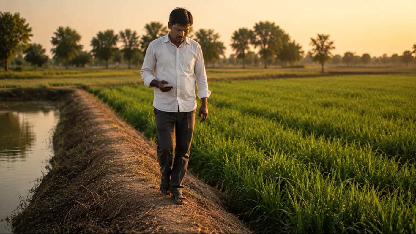
Almost every decision on your farm is priced per unit of area — seed rate, fertiliser dose, spray volume, labour, subsidy ceilings, rent, and the split when you share a crop. Yet a surprising number of farmers work from an area figure they inherited, guessed, or copied off an old document. A phone can settle it in about ten minutes. It can also mislead you, and knowing the difference is most of this guide.
Why the number matters more than farmers expect
Get your area wrong by fifteen per cent and every per-acre recommendation you follow is wrong by fifteen per cent. Under-apply and you leave yield in the field; over-apply and you have bought fertiliser you did not need, which is the more common and more expensive mistake. Seed rate suffers the same way — thin stands and wasted seed both trace back to a bad area figure.
It also matters administratively. Scheme ceilings are usually written per hectare, drip and sprinkler subsidies are sanctioned against a stated area, and crop insurance and procurement paperwork all reference it. If the area you declare does not match your records, applications stall — which is exactly the failure mode described in our iKhedut portal guide.
The manual method, and its honest limits
For a plot that is genuinely rectangular, area is length × breadth, and a measuring tape or chain gives a good answer. Measure each side twice and take the average; on uneven ground, keep the tape level rather than following the slope, because a tape laid along a slope reads longer than the ground area actually is.
Triangles are almost as easy. If you know all three sides, Heron's formula gives the area: take s as half the perimeter, then area is the square root of s × (s−a) × (s−b) × (s−c). This is worth knowing because it unlocks the irregular case — any four-, five- or six-sided plot can be split into triangles by drawing diagonals, measuring each one, and adding the areas together.
Where the manual method genuinely struggles is a boundary that curves, follows a stream, or has been nibbled at over generations. Splitting a wandering boundary into triangles means a lot of measurements, and every measurement adds a little error. This is the case GPS handles far better.
- Rectangle: length × breadth. Measure each side twice, keep the tape level.
- Triangle: Heron's formula from the three side lengths.
- Irregular plot: split into triangles with diagonals, measure each, add the areas.
- Always close the shape — if your sides do not join back up, one measurement is wrong.
How phone measurement actually works
There are two methods, and they fail in different ways, so pick deliberately rather than by habit. The first is walking: you turn on tracking and walk the boundary, and the phone records your position continuously to trace the shape. The second is tapping: you look at satellite imagery of your field and drop a pin at each corner, and the app computes the area of the polygon you have marked.
Farmers assume walking must be more accurate because it involves the actual field. Often it is not. Walking inherits every wobble of your phone's GPS — you drift a metre or two off the true line constantly, and under a tree canopy or beside a tall building the drift gets considerably worse. Tapping corners on clear satellite imagery avoids drift entirely and is frequently the better method for a plot with visible, straight boundaries.
Tapping has its own weakness: the imagery may be a year or two old, so a bund you moved last season is not shown, and it needs the boundary to actually be visible from above. For a field hidden under mature orchard canopy, walking wins. The practical answer is to use both once on the same plot and see how close they land — if the two agree within a couple of per cent, you can trust either from then on.
Realistic accuracy, and why plot size changes everything
An ordinary phone under open sky is typically accurate to a few metres, not centimetres. That single fact has a consequence most guides skip: the same absolute error is a very different percentage depending on how big your plot is. A two-metre error around the edge of a large field barely moves the total. The same two metres around a small vegetable plot can shift the area by a tenth or more, because the boundary length is large relative to the enclosed area.
So treat a phone reading as reliable for planning on a normal field, and treat it with real caution on a very small plot. Improve it where you can: measure under open sky rather than beside a wall or under trees, stand still for a few seconds at each corner before marking it so the position settles, mark more points along any curve rather than cutting it as a straight line, and repeat the measurement on a different day. If two attempts differ by a lot, the ground conditions are working against you.
- Measure in open sky; canopy, walls and wet weather all degrade the fix.
- Pause a few seconds at each corner so the position settles before marking.
- Add extra points along curves — a curve cut as a straight line always under-reads.
- Walk or mark the complete boundary and close the shape back to your first point.
- Repeat once on another day. Two close readings mean you can trust the figure.
Bigha is not one unit — this catches people out
Here is the part that causes real financial confusion: bigha is not a national standard. It differs from state to state, and sometimes between districts, so a figure in bigha means nothing until you know whose bigha it is. Converting with the wrong factor is one of the most expensive arithmetic errors in Indian farming, and it happens most often in land dealings and subsidy applications.
By the Gujarat convention, one bigha — usually called a vigha — is 17,424 square feet, which is exactly 0.4 acre or 16 guntha. For reference, one acre is 43,560 square feet, one hectare is 10,000 square metres or about 2.47 acres, and one guntha is 1,089 square feet. Our land unit converter uses these figures and states the convention on every page, so you can see exactly what is being assumed rather than trusting an unlabelled number.
If your land is in another state, confirm the local factor against your revenue records before you convert anything that matters. And when you fill a scheme form that asks for hectares while you think in vigha, convert carefully — getting that wrong by a factor of two and a half is a common and entirely avoidable rejection.
What a phone measurement must never be used for
This is the most important paragraph here. A GPS area from a phone is a planning estimate. It is not a legal survey, and it carries no legal standing whatsoever. Do not use it for land records, a sale deed, a partition between family members, a mutation application, or any boundary dispute with a neighbour. For all of those you need the revenue authority — your talati or the district land records office — and an official survey, with the area as it stands in your 7/12 and 8-A extracts.
Treat the two as separate numbers with separate jobs. The official record governs ownership, tax and any transaction. The phone measurement tells you how much seed to buy and what your cost per acre really is. Farmers get into trouble precisely when they let a convenient phone reading override a document, or quote it in a dispute where it has no weight.
Turning the area into decisions
Once you have a figure you trust, use it. Recalculate your seed rate and fertiliser dose against the real area rather than the inherited one — this alone often reveals that a farmer has been over-applying for years. Then put the area into the farming cost and profit calculator to get an honest cost per acre and the break-even price your crop actually needs, which changes how you negotiate at the mandi.
Pair it with a soil test so dose recommendations are matched to both your area and your soil — how to read a soil health card explains why the per-hectare recommendation on the card has to be converted to your unit before you buy anything. And when you come to sell, check today's mandi bhav so the price you accept is based on the market rather than a guess.
In Khetiyaar, land measurement sits alongside the crop plan, so the area you measure feeds the plan's seed and fertiliser quantities directly — the kheti app is free to start, and the area figure is yours to edit if you know the record better than the satellite does.
Frequently asked
Which is the best app to measure land in bigha or acre?+
The useful question is not which app, but whether it states the convention it is using. Bigha differs by state, so an app that shows a bigha figure without saying which bigha can mislead you. Khetiyaar's land measurement reports area in acre, bigha, vigha, guntha and hectare, and the land unit converter states plainly that its bigha follows the Gujarat convention of 17,424 square feet.
How accurate is measuring a field with a mobile phone?+
An ordinary phone under open sky is typically accurate to a few metres rather than centimetres. That error is a small percentage on a large field and a much bigger percentage on a small plot, because the boundary is long relative to the area enclosed. Measure in the open, pause at each corner, and repeat on another day — two close readings mean you can rely on the figure for planning.
What is the formula to measure an irregular field?+
Split it into triangles using diagonals, measure each triangle's three sides, and use Heron's formula on each: with s as half the perimeter, area is the square root of s × (s−a) × (s−b) × (s−c). Add the triangle areas together. It works, but every extra measurement adds error, which is why GPS handles wandering boundaries better.
How many square feet is one bigha?+
It depends on the state — bigha is not a national standard. By the Gujarat convention one bigha or vigha is 17,424 square feet, exactly 0.4 acre or 16 guntha. Other states use different factors, so confirm the local one against your revenue records before converting anything that affects money.
Can I use a GPS measurement for my land records or a property dispute?+
No. A phone GPS area is a planning estimate with no legal standing. Land records, sale deeds, partitions, mutations and boundary disputes all require an official survey through the revenue authority, and the area recorded in your 7/12 and 8-A extracts. Use the phone figure for seed, fertiliser and cost decisions only.
Is walking the boundary better than marking points on a satellite map?+
Not usually, which surprises people. Walking inherits continuous GPS drift and gets noticeably worse under tree canopy or beside buildings. Marking corners on clear satellite imagery avoids drift and is often more accurate for straight, visible boundaries. Walking wins where the boundary is hidden from above, such as under a mature orchard.
Where to go next
Want this as daily tasks for your farm?
Khetiyaar turns guides like this into a day-by-day plan — in your language, free to start.

Related guides
Cumin Farming: Growing Jeera When the Weather Decides Everything
Cumin is among the highest-value crops a Gujarat farmer can grow and among the easiest to lose. Two cloudy weeks at flowering can take the whole field. Here is how to give it the best odds.
Isabgol Farming: Growing Psyllium for the Husk, Not the Seed
North Gujarat supplies much of the world's psyllium husk from light land and almost no water. The crop is easy until harvest — and at harvest one shower can take the value out of it.
Castor Farming in Gujarat: Erandi from Sowing to the Last Picking
Gujarat grows most of India's castor, and India supplies most of the world's. A deep-rooted crop for light land that pays across several pickings — and one you must never treat as food or fodder.